NavBrief
Do you know where your ship is? Now imagine that the satellite navigation system has failed, and the position is now longer marked on the ECDIS – or is showing as somewhere the ship cannot possibly be. Now what happens?
with David Patraiko FNI Director of Projects, The Nautical Institute
GNSS Denial
Global Navigation Satellite Systems (GNSS) have become almost indispensable to maritime navigation today. We are not unique in this, as everything from car satnavs to international banking and telecommunication systems relies on GNSS for positioning, navigation and timing (PNT).
Unfortunately, although GNSS has proved to be very reliable and accurate, it is becoming much less reliable, particularly in regions where there is conflict or upheaval. The trouble generally can be divided into two categories: jamming and spoofing.
Jamming and spoofing
GNSS signals are generated from satellites which are largely solar powered, the transmitted signal power tends to be fairly weak. That weak signal can be degraded or totally denied by either intentional or unintentional activity. Unintentional jamming could be caused by environmental conditions such as solar flares, or by malfunctioning land based sources such as powerful radar or TV transmissions.
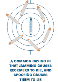
Spoofing is far more rare but also harder to detect. This is when a real signal is masked with a fake signal, providing plausible false positioning information to the mariners onboard ships. A common saying is that jamming causes receivers to die, and spoofing causes them to lie.
As a navigator, you must be aware of these risks and how to react if they are detected or even suspected.
Fortunately there is a wide range of information sources available to assist, and for the alert mariner, some reasonably effective countermeasures that will keep the ship safe. An excellent source is the InterTanko guide Jamming and Spoofing of Global Navigation Satellite Systems (GNSS), which is available to InterTanko members and also from some security sources (the current version was published in 2019 but an update is expected later this year).
Don’t panic!
While the loss of GNSS is certainly concerning, navigators have been managing safely without it for thousands of years. The golden rule has always been never to rely on any one source of positioning. For this purpose all GNSS systems (GPS, Galileo, GLONASS or BeiDou (BDS)) should be considered as a single source – they all have similar risks due to their common transmission bands and weak power. It is critical that that mariners constantly take fixes and check the resulting position against the one given on ECDIS using other means – radar, visual navigation, physical aids to navigation celestial, depth sounder, ECDIS interlays (overlays and underlays), parallel indexing or even dead reckoning (DR) and estimated positions (EP).
The results should be compared with GNSS information to check plausibility. If there is any doubt, the Master should be called immediately and consideration be given to slowing or stopping the ship to ensure safety. It is also essential that all watch keepers, both officers and lookouts, are familiar with the signs of GNSS denial and that the bridge team practises good BRM techniques, mentoring and good situational awareness. The professional navigator must be skilled in manually plotting positions on the ECDIS. Regular drills are also a good idea.
On a final point, the magazine has had a refresh in design to celebrate its 40th issue. We hope you enjoy your new-look Navigator!