201738 Mystery collision reveals GPS anomaly
Edited from official BSU (Germany) report 276-14
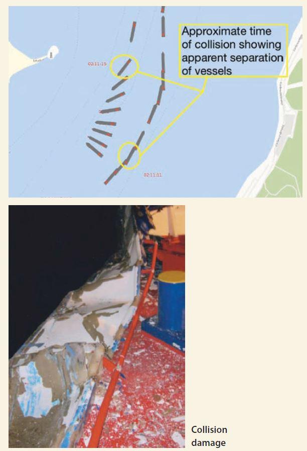
In the early morning darkness and in good visibility two small cargo vessels were navigating within the confines of a river port. One was outbound, the other inbound, and both were under self-pilotage. Both vessels were equipped with the same electronic chart by a reputable equipment manufacturer. As the vessels approached their meeting point at a bend in the waterway, some crew on the inbound vessel’s foredeck reportedly saw, at close range, the masthead lights and red sidelight of an oncoming vessel that appeared to be quickly closing on a collision course.
The crew members on the inbound vessel had only enough time to run for cover before a glancing collision occurred. The investigation uncovered that both electronic charts showed that the vessels had never made contact and were separated by a reasonable distance. Yet, incontestably, a collision had occurred.
The investigation was unable to arrive at a definitive explanation for the apparent separation of the vessels as presented on the respective ENCs versus their true positions. There appears to have been some sort of GPS anomaly or signal shadowing.
Lessons learned
● Electronic navigation charts greatly increase the situational awareness of the bridge team, but ENCs must not be relied upon exclusively for positioning or collision avoidance.
● Keep double-checking your position and targets with other instruments and, especially in pilotage waters, be sure to look out of the front window.