
ENC Place Names and scale
Names for important navigational marks - does not appear to be any logical method in ENCs
ENC Place Names? Who puts the Names for important Navigational marks (Headlands/Capes/Outcrops/Islands/Lights etc...) onto ENCs. They appear to be completely random. We are training the next group of Navigators to operate on a Large scale ENCs on a 24" screen competently - but they have no idea where they are in a geographical concept.
Example is rounding Lands End in Cornwall - most traditional "old School" navigators know we are rounding Lands End (SW tip of UK) but a new to Sea 3/0 can only see its place name as St Buyran - 6 miles in land! A further example is in the Peloponnesus straits - No mention of Cape Matapan! As Captain asking when we will be south of Cape Matapan (Famous for 1941 Naval Battle) - silence from the 3/0 as it does not feature on the ENC. ENC chart names should follow the old Admiralty Chart names which gave a good geographical indication of where the ship was. ENC are great but we also need Charts with easy to read place names, less clutter and better Name layout - somewhat like a hybrid ARCS/ENC?
Another thought on the ENC place names... As you increase range i.e. move out from 6 miles to 12, 24 then 48 miles, could not the place names reduce (drop away) so to avoid clutter and the overwriting that occurs at present.
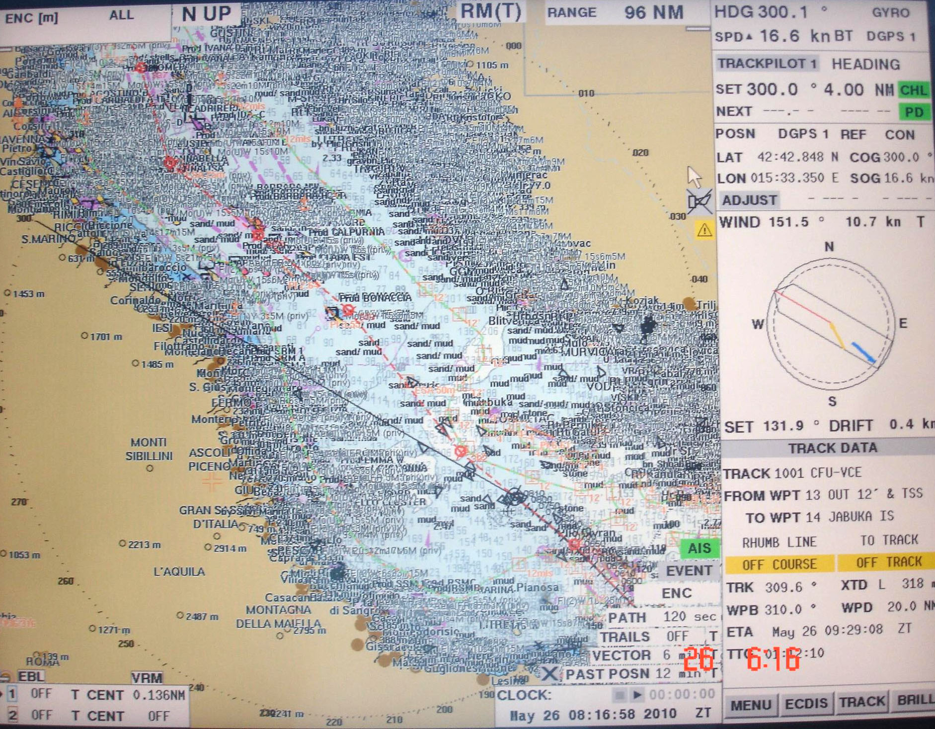
Possibly a fix for the new S101 ENCs? So the change of range on an ENC would be like changing scale on the old paper charts, ending up on the 4000 series with only major points marked.
RESPONSE
Supplied by the UK Hydrographic Office
These questions raise a number of inter-related issues. ENC producers are constrained by the current S57 and S52 standards and these make it extremely difficult to produce an ENC that has cartographic qualities similar to those honed over many decades with the paper chart. Experience gained from use of the current generation of ENCs in ECDIS will indeed be fed into future standards and more intelligent text placement is one of the features that is being looked at in S-101 the future standard for ENCs.
However investigations into specific instances reported to us, like the case of the text for ‘Lands End’ in question E4 show that we can improve matters in the short term as well. In this particular case it is useful to have a general understanding of how names / text are captured and included in ENCs.
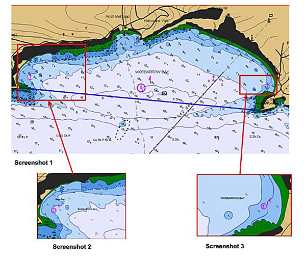
Name placement in ENCs
Text placement in ENCs is dependent on the type of feature being captured and largely rules based in the way it displays in an ECDIS. Names appearing on paper charts will be captured on the ENC of equivalent scale. The names are ‘attributed to’ objects within the ENC – for instance in the example below, the name ‘Worbarrow Bay’ has been attributed to the area of sea to the north of the blue line shown in the screen shot below. This area is defined in the ENC as a set of points describing a polygon covering the area of water from the coastline out to the blue line. By coding the name in this way the text will always be placed in the centre of that part of the area shown on the ECDIS screen. This is shown in the screenshots below.
In screenshot 1 where the whole bay is shown as in the name is in the centre of the area; in screenshots 2 and 3, where the user has zoomed in to areas at either end of the bay, the name follows. This ‘dynamic’ display of names should ensure that important names remain on screen as the user zooms and pans across ENCs.
However this very intelligence can cause some of the problems with over-writing of text. An example of this can be seen in screenshot 4 below where the name ‘Lands End’ doesn’t stand out clearly as it is being displayed in an already ‘busy’ part of the ENC. The text is being placed by the ECDIS at the centre of the land area defined as ‘Lands End’ (the green area in the inset of screenshot 4).
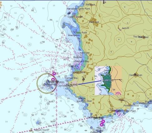
Screenshot 4