
Data Presentation
Information on objects via 'pick reports'
Recently I piloted a coastal tanker that has been running paperless using ECDIS for 5 years so the Captain and officers were all
familiar with it. The first thing that I noticed was that the operating menus are totally different to the latest ECDIS from the same manufacturer so there are already potential issues with manufacturers refining their operating systems and changing layouts / menus with new models as they have always done with radar.
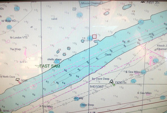
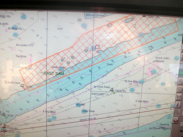
Although I was able to locate the key functions what I found has made me concerned over the ENC data and the way that it's presented. In particular in this instance is the identification and marking of anchorages which is of particular importance on the Thames where many coastal vessels are exempt from pilotage through the outer estuary. Frequently these smaller vessels are required to anchor in a designated anchorage area known as the "Mouse" anchorage which is situated to the East of the Sea Reach and Medway channels.
Recently, we have been experiencing an increasing number of cases where these vessels, upon being instructed to proceed to the Mouse anchorage, have not known where it is located and have requested the Lat & Long position. Since the anchorage is clearly marked on the paper chart such ignorance seemingly indicates an incompetent navigator with all the associated compliancy issues involved. However, even in the best run vessel, such ignorance is understandable because if they are using ECDIS the anchorage areas are not identified on any of the ECDIS layers and the name can only be discovered by using a pick report. Even using the pick report, the information is almost impossible to find since the name is hidden within pages of data.
The following screen shots help to explain this:
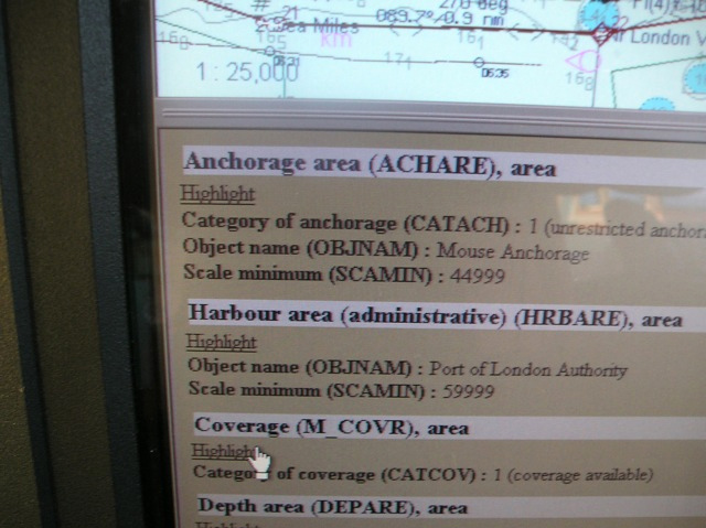
Hunting around the screen reveals the almost invisible Mouse anchorage outline with the anchor symbol that can be clicked on (Fig 1) to obtain the pick report.
NB: You have to click on the anchor rather than the general anchorage, otherwise you just get everything you never wanted to know about the Warp area! This brings up pages of data so the logical place to find the name of the anchorage is in "general info" Fig 2
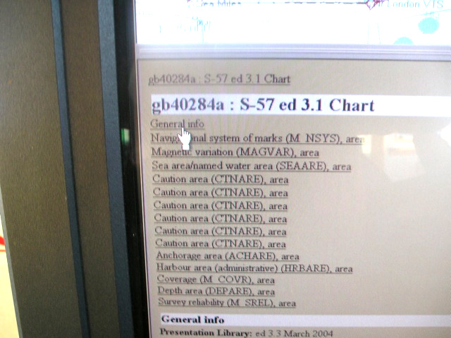
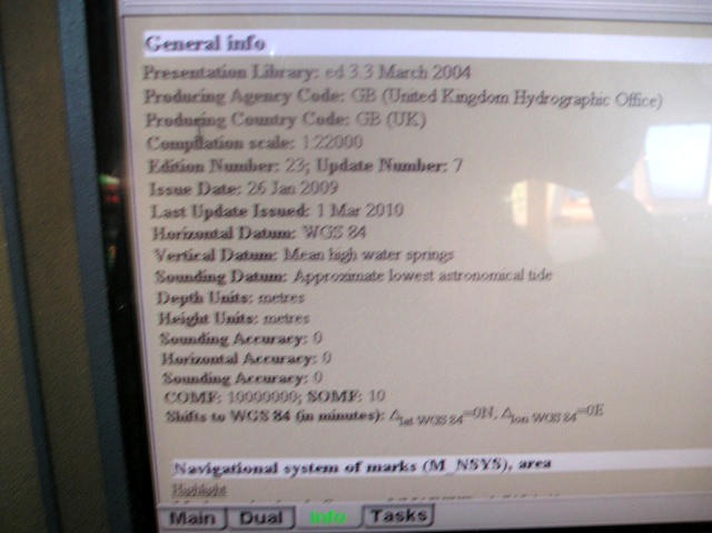
Wrong! This is the general info! (Fig 3)
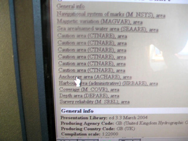
Hunting the index we find an item "anchorage area" well down the list in position 11!
Fig 4 Eureka! There it is, 2nd on the list referred to as "object
2nd on the list referred to as "objectname" (Fig 5)
At least once you've found it you can highlight the anchorage!(Fig 6.)
With several anchorage areas in the Thames Estuary all this tedious process begs the question as to how on earth is any navigator going to find the Mouse anchorage when instructed to anchor there? There is an urgent need for all anchorage names to be included on the "standard display" mode.